
Ruiny schroniska pod Ostrym Wierchem
 Main info


...")


?
/
??
GPS WGS84:
48° 52’ 56.5” N
22° 57’ 30.5” E
Added by: Starszy Zuch (01/05/2011 - 01:47:20)
Added by: Starszy Zuch (01/05/2011 - 01:47:20)
Map
Objects in the surroundings

There have been 1 other objects found in the area, if you know of any others, try adding them here...
Gallery
1961
06/02/2022 - 01:47:20
Starszy Zuch
1962

06/02/2022 - 01:47:20
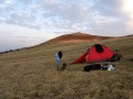
Super miejsce na biwak.
Starszy Zuch
There are 2 of pictures in the gallery, if you have some more, you can upload them here...
Notes
01/05/2011 - 14:04:06
Pozdrawiam chłopaków z Polski - K. i P.
Starszy Zuch
There are 1 notes for this object...
© www.boudy.org | all informations without guarantee | PHP 8.3.30 | MySQL 11.4.10-MariaDB-ubu2204-log | last change: 06/01/2024 - 22:05:09 V.A.