
Srub Rokytka
Czech Republic, Jevišovická pahorkatina, Znojemská pahorkatina, Tavíkovická pahorkatina | 345 m a.s.l.
 Main info


...")


6
/
10
GPS WGS84:
49° 2’ 30.29” N
16° 3’ 19.12” E
Added by: Rendy (23/12/2010 - 00:15:01)
Last edit: VA (11/05/2023 - 18:38:13)
Added by: Rendy (23/12/2010 - 00:15:01)
Last edit: VA (11/05/2023 - 18:38:13)
Map
Objects in the surroundings


There have been 7 other objects found in the area, if you know of any others, try adding them here...
Gallery
1906
06/02/2009 - 00:15:01
Zima 2009.
Rendy
1907
06/02/2010 - 00:15:01
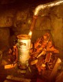
Kamna.
Rendy
1908

06/02/2012 - 00:15:01
Srub Rokytka
Jarda
1909

06/02/2012 - 00:15:01
letos na jaře
Rendy
1910

06/02/2012 - 00:15:01
vnitřek letos na jaře
Rendy
There are 5 of pictures in the gallery, if you have some more, you can upload them here...
Notes
There is no comment on this object yet, so if you know something, try to add it here...
© www.boudy.org | all informations without guarantee | PHP 8.3.30 | MySQL 11.4.10-MariaDB-ubu2204-log | last change: 06/01/2024 - 22:05:09 V.A.