
Bouda v sedle Jama
 Main info


5
/
7
GPS WGS84:
48° 59’ 48.67” N
19° 18’ 40.75” E
Added by: Boro (09/09/2009 - 03:46:48)
Last edit: Jarda (13/09/2016 - 03:46:48)
Added by: Boro (09/09/2009 - 03:46:48)
Last edit: Jarda (13/09/2016 - 03:46:48)
Map
Objects in the surroundings


There have been 28 other objects found in the area, if you know of any others, try adding them here...
Gallery
1743

1738
1739
There are 7 of pictures in the gallery, if you have some more, you can upload them here...
Description
- table
- benches / chairs
- clay floor
V přízemí hliněná podlaha, stůl, lavice, zbytky kamen leží na zemi - nepoužitelné. V době mé návštěvy (8.2009) velký nepořádek. Mnohem lépe vypadá podkroví - vchod zevnitř po žebříku, bylo čisté, vybavené dekami. Střecha by zatékat neměla.
Water source
Stav 2016:
1. studánka s napajedlem asi 80 m směr JJZ, od boudy není vidět - je za horizontem. Pitná voda.
2. napajedlo asi 150 m JV, rozšlapané od krav.
Best time to visit
Asi kdykoliv...
Access
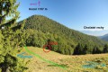
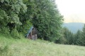
Asi 20 m u zelené značky Podsuchá - Biely Potok, mezi vrcholy Brankov a Veľký brankov.
Notes
There is no comment on this object yet, so if you know something, try to add it here...
© www.boudy.org | all informations without guarantee | PHP 8.3.31 | MySQL 11.4.10-MariaDB-ubu2204-log | last change: 06/01/2024 - 22:05:09 V.A.