
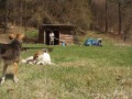
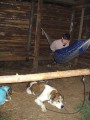
Dřevěná bouda u Skryjí
Czech Republic, Hornosvratecká vrchovina, Nedvědická vrchovina, Pernštejnská vrchovina | 342 m a.s.l.
 Main info


5
/
10
GPS WGS84:
49° 23’ 36” N
16° 17’ 47” E
Added by: Jelos (24/08/2005 - 18:34:28)
Added by: Jelos (24/08/2005 - 18:34:28)
Map
Objects in the surroundings


There have been 9 other objects found in the area, if you know of any others, try adding them here...
Gallery
1064
1065
There are 2 of pictures in the gallery, if you have some more, you can upload them here...
Description
...
Water source
...
Best time to visit
Asi kdykoliv...
Access
U vesnice Skryje.
Notes
There is no comment on this object yet, so if you know something, try to add it here...
© www.boudy.org | all informations without guarantee | PHP 8.3.30 | MySQL 11.4.10-MariaDB-ubu2204-log | last change: 06/01/2024 - 22:05:09 V.A.