
Salaš Kotliská
 Main info


...")


5
/
10
GPS WGS84:
48° 55’ 47.04” N
19° 32’ 34.39” E
Added by: proflier (12/03/2005 - 23:28:39)
Added by: proflier (12/03/2005 - 23:28:39)
Map
Objects in the surroundings


There have been 10 other objects found in the area, if you know of any others, try adding them here...
Gallery
3536
There are 1 of pictures in the gallery, if you have some more, you can upload them here...
Description
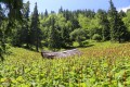
Older hut, presently damaged by an avalanche.
Water source
...
Best time to visit
Unlimited.
Access
1. From Krížske sedlo descent to Vajskovská dolina, about 40 min. The trail is currently closed by NAPANT.
2. From Dolna Lehota along the green marker, about 4. hr.
- Nízke Tatry C4
Notes
There is no comment on this object yet, so if you know something, try to add it here...
© www.boudy.org | all informations without guarantee | PHP 8.3.31 | MySQL 11.4.10-MariaDB-ubu2204-log | last change: 06/01/2024 - 22:05:09 V.A.