
Rozdroze Tzrech Bukow
Poland, Góry Krucze - Vrani hory, undefined part of the mountain range, undefined area | 700 m a.s.l.
 Main info


...")


2
/
3
GPS WGS84:
50° 40’ 23.66” N
16° 1’ 22.91” E
Added by: scinkk (27/08/2013 - 18:29:37)
Added by: scinkk (27/08/2013 - 18:29:37)
Map
Objects in the surroundings


There have been 12 other objects found in the area, if you know of any others, try adding them here...
Gallery
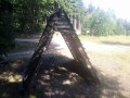
2472
22/02/2013 - 18:29:37
Pristresek na rozcesti modra-zluta-cervena.
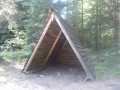
2473
22/02/2013 - 18:29:37
Pristresek na rozcesti modra-zluta-cervena.
scinkk
There are 2 of pictures in the gallery, if you have some more, you can upload them here...
Notes
There is no comment on this object yet, so if you know something, try to add it here...
© www.boudy.org | all informations without guarantee | PHP 8.3.30 | MySQL 11.4.10-MariaDB-ubu2204-log | last change: 06/01/2024 - 22:05:09 V.A.